Agrowhere offers innovative mapping solutions.
We specialize in the following: Drainage Enterpises maps and management tools,
farm production indexes, agriculuture drainage design tools
and centralized databases to supplement the land planning decision making process.
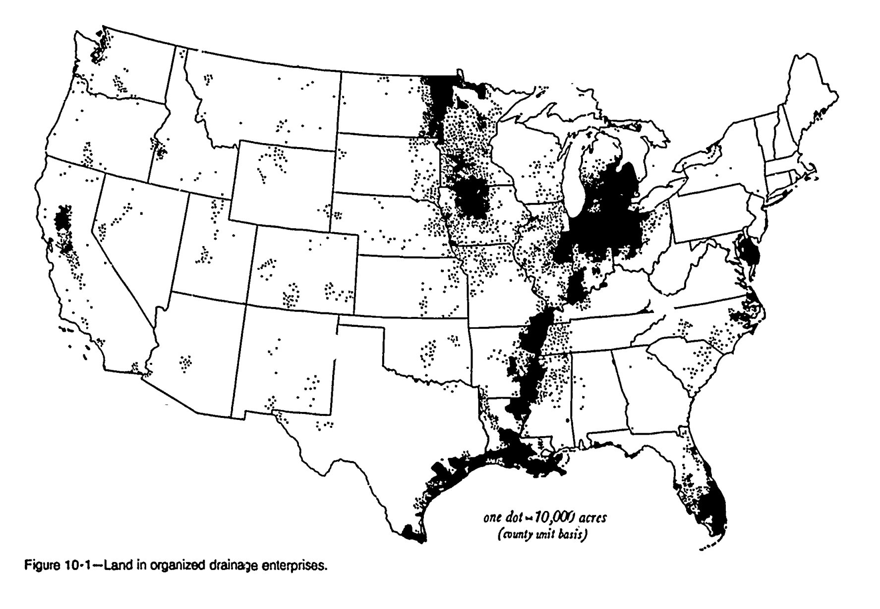
Drainage USA is an effort to map all Drainage Enterprises and infrastructure in the USA.
Find Out MoreTools to understand the drainage productivity of the farm, including problematic areas, proximity to Drainage Enterprises, and other applicable datasets related to drainage.
Modernize Drainage Enterprise (Drainage District) records with a standalone Drianage District map. These maps lead towards simplified management procedures for your organization. Learn More About Drainage District Mapping
Technical assistance for land use decisions related to proposed developments, natural resource concerns and highlighting the unrecognized values of certain agriclutural ground.
Interactive web maps to help aid well informed land use decisions for end users of many different technical backgrounds.
Access the map and enhance your understanding of your district. Contact us for user credentials.
Explore MapIf you're a Drainage District Commissioner seeking technical or administrative support, explore our services today.
Get AssistanceOrganize historical records.
Convert records into digital format.
Create detailed maps.
Review the maps data with Commissioners and other Stakeholders.
Deliver the finalized maps incorporating revisions